The irrigation district in Guangdong faces challenges due to its vast coverage, scattered infrastructure, complex terrain, and uneven spatiotemporal distribution of rainfall. Existing conditions—including diverse climates, soil types, crop growth patterns, and dynamic water resource availability—hinder optimal water allocation and the goals of agricultural water pricing reform.
The Metering Information Management System aims to:
Establish a comprehensive, coordinated digital framework focused on water usage management.
Enhance irrigation efficiency through digitization, networking, automation, and standardization.
Enable data-driven water allocation and conservation via real-time monitoring, analysis, and decision support tools.
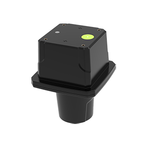
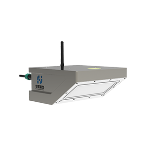
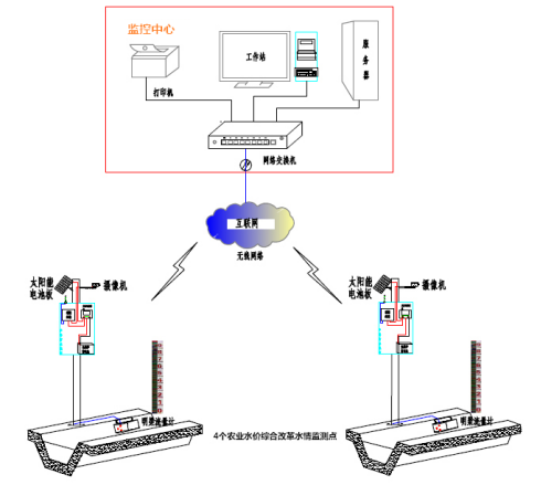
Huaju Scientific Instruments’ integrated radar monitoring equipment provides a one-stop solution:
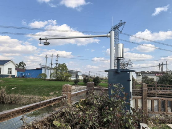
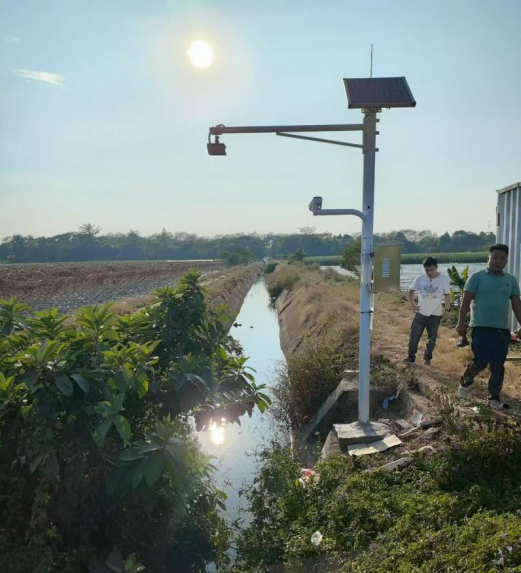
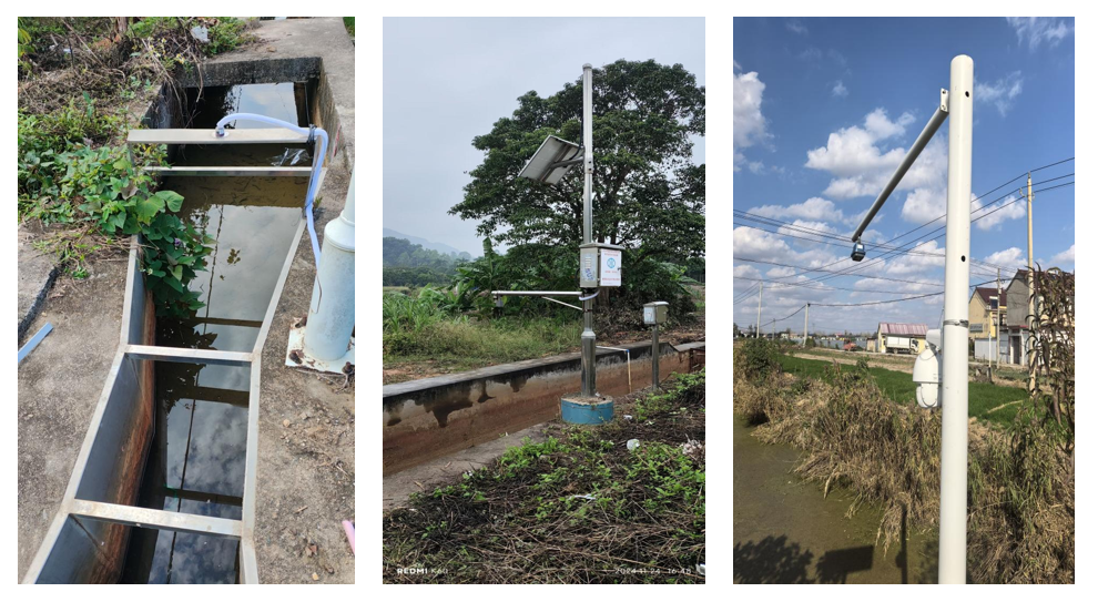
Telemetry Station Deployment:
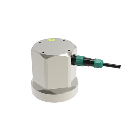
Install integrated radar flow meters and open-channel flow meters (Parshall flumes) to enable automatic collection, transmission, and visualization of water level, flow rate, and image data.
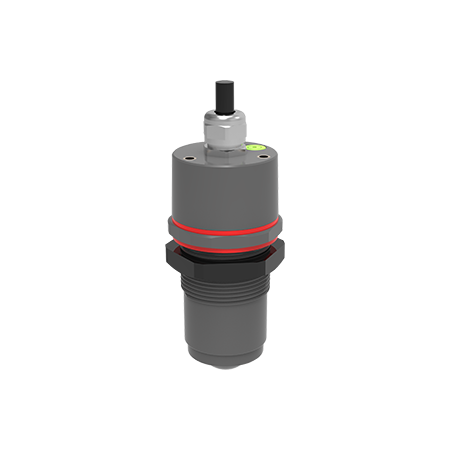
Automated Water Measurement:
Deploy low-power level gauges for automated water level monitoring and reporting.
System Integration:
Integrate newly established telemetry stations into the existing metering information system.
Centralize data management, queries, and display through a unified platform and mobile applications.
Precision Water Allocation: Real-time data optimizes water distribution across the irrigation network.
Enhanced Operational Efficiency: Automation reduces manual intervention and resource waste.
Scalable Infrastructure: Modular design supports future expansions and upgrades.
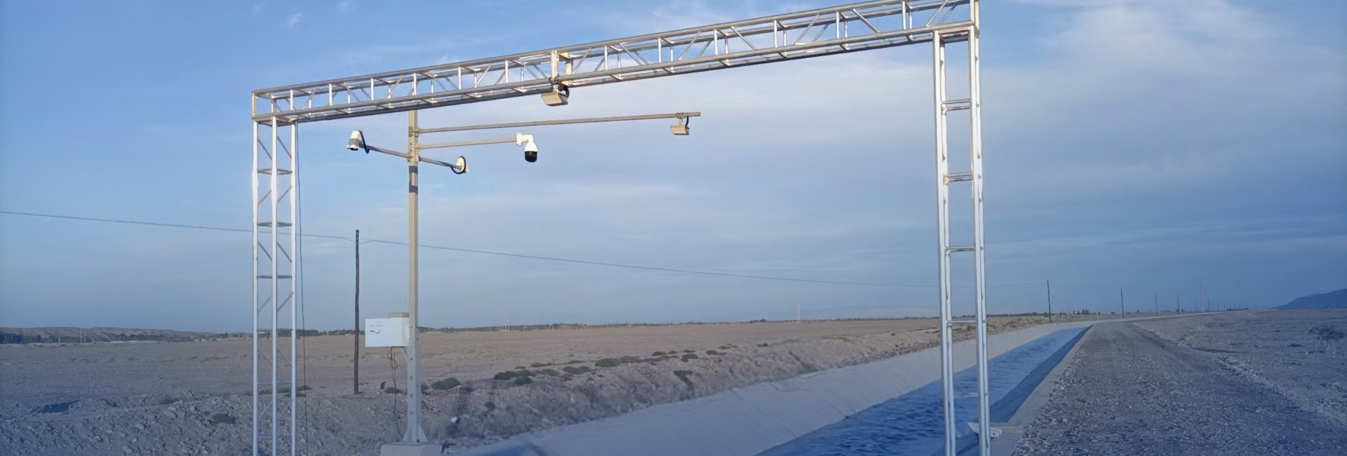
Site of Application