Flow measurement in open channels and rivers is a critical component of hydrology and water conservancy engineering. Real-time data collection on water level, flow velocity, and discharge through flow monitoring systems holds significant importance for water resource management, flood control and disaster mitigation, hydraulic engineering planning, and environmental protection.
Common practices include manual methods, cableway systems, acoustic Doppler techniques, and radar wave-based measurements. Each method has distinct characteristics, advantages, and limitations. For scenarios requiring long-term, real-time online monitoring, minimal civil engineering and installation complexity, ease of maintenance, immunity to water quality or sediment interference, operator safety, and reliable performance during high-velocity flood conditions, radar wave flow measurement is widely regarded as the most practical and trusted solution. 
The radar-based approach relies on the velocity-area method, where discharge = average velocity × cross-sectional area. A radar velocity sensor probe captures surface velocity, which is converted into the average cross-sectional velocity using predefined hydraulic models and cross-sectional parameters stored in the radar flow meter. Simultaneously, a radar water level sensor measures water depth, enabling the device to automatically calculate the cross-sectional area based on geometric parameters. Combining these values via the velocity-area formula yields the final discharge. 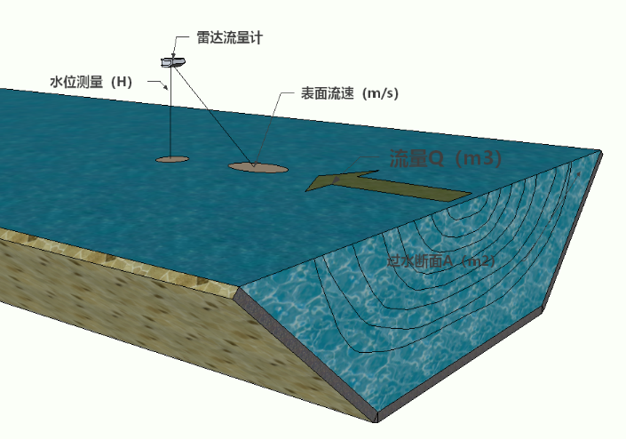
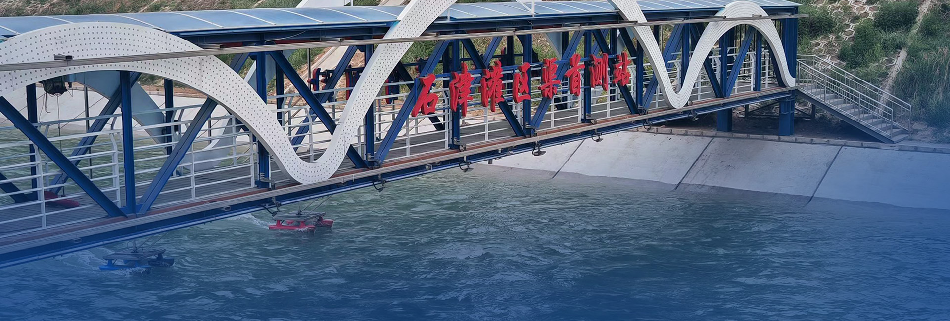
For channels or river sections with widths ≤15–20 meters, a single radar flow meter is typically installed at the center of the cross-section. For wider sections, an array-based radar measurement system is recommended, deploying radar velocity sensors (subunits) and flow meters (main units) across multiple vertical measurement lines.
Radar Wave Flow Measurement Solution
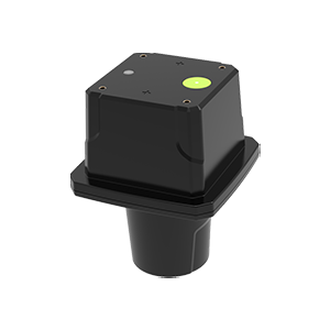
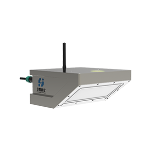
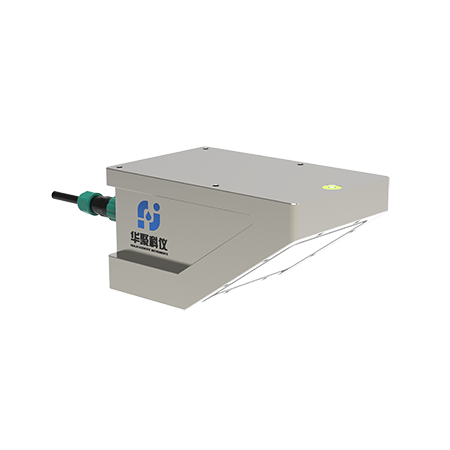
The RD-600 Series Radar Flow Meter of ShenZhen Huaju Scientific Instruments C.,ltd. employs planar microwave technology and Doppler radar principles to measure surface velocity, alongside integrated microstrip radar for water level detection. Using the velocity-area method, it calculates cross-sectional area from water level data and converts surface velocity to average velocity through empirical formulas for circular, rectangular, and trapezoidal channel velocity profiles. This non-contact solution ensures accurate discharge measurement without altering channel, river, or pipeline boundaries.
Key features include:
Support for digital (RS485, RS232) and analog (4-20mA) interfaces.
Low power consumption, compact design, high reliability, and user-friendly operation.
Immunity to environmental factors such as temperature, air pressure, sediment, debris, pollutants, and floating objects.
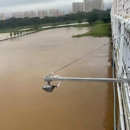
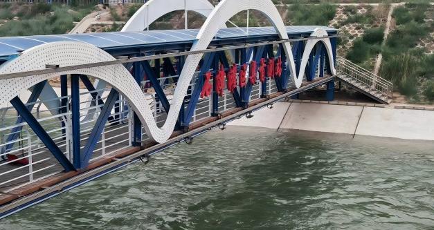
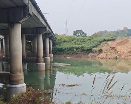
The RD-600 or its integrated variant, the RD-600-R (with built-in RTU), is typically installed via pole-mounted brackets or under-bridge setups.

Cloud Management Platform
All monitoring solutions and installation methods enable wireless data transmission (via built-in or external RTUs) to the Huaju Keyi Cloud Platform. Users can access real-time and historical data, equipment status, water level-height relationship graphs, voltage diagnostics, installation locations, and even live images or videos when integrated with cameras.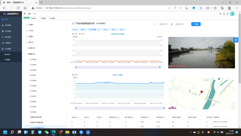
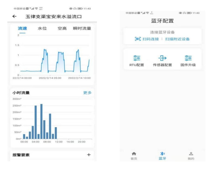
Mobile APP for Configuration and Monitoring
The Huaju Scientific Instruments Pocket APP allows Bluetooth connectivity for configuring channel parameters and viewing real-time data. For devices with RTUs, users can set IP/port settings remotely via the APP, enabling anytime, anywhere access to uploaded data for seamless monitoring and management.
System Topology Diagram of the Solution 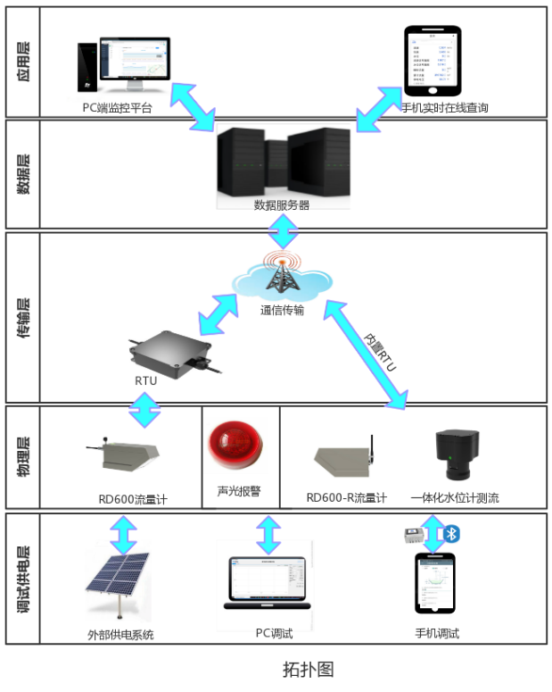
Solution Advantages
1.Non-Contact, Maintenance-Free Operation
Unlike contact-based sensors vulnerable to damage from debris during floods, radar wave systems require no physical contact with water, ensuring durability and eliminating maintenance.
2.24/7 Multi-Dimensional Monitoring
Low-power radar flow and water level meters support solar or lithium battery power, enabling uninterrupted all-weather operation.
3.Simplified Installation
Pole or bridge-mounted setups eliminate the need for in-water construction, allowing deployment during both flood and dry seasons.
4.Adaptability to Diverse Conditions
Radar systems operate reliably regardless of water depth, functioning stably in both flood and low-flow scenarios across varied environments.